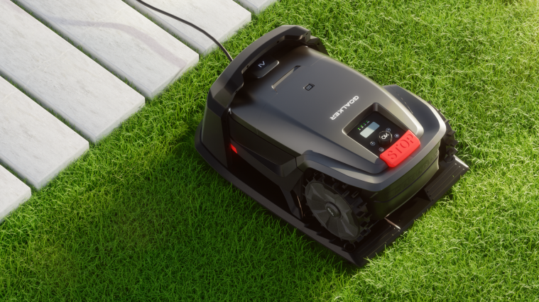
Managing a 40-acre golf course or a sprawling corporate campus with consumer-grade robot mowers leads to costly failures: lost units, missed patches, and safety liabilities that no procurement manager wants tied to their name. Commercial lawn care requires proven, industrial-grade engineering. The gap between a residential bot that drifts off-course near a flowerbed and a fleet-ready machine that navigates multi-acre terrain with centimeter-level accuracy comes down to specific technologies, starting with how the mower actually knows where it is.
This guide covers how RTK GPS lawn mower systems outperform traditional boundary wire vs wire-free mower setups, why obstacle detection robot mower technology matters for public spaces, and what to check before signing a purchase order. If you’re evaluating equipment for scale, this is the technical due diligence you need before the budget meeting.
Precision Navigation Technology: RTK-GPS/GNSS vs Boundary Wire Systems
Two navigation philosophies dominate commercial-grade robotic mowing today, and the choice shapes everything from installation timelines to long-term maintenance costs. Each system pinpoints the mower's location on your property differently.
RTK GPS lawn mower systems, like Husqvarna's EPOS technology, use satellite-based RTK-GNSS to set virtual boundaries. In open sky, accuracy is 1–2 cm with reference stations like RS 4G and RS5, though real-world performance across varied terrain typically falls in the 1–6 cm range. That precision drops under trees or near buildings because sky masking and multipath interference disrupt the satellite signal. This matters for golf courses and campuses with both open fields and wooded zones.
The two reference-station options serve different site sizes. RS 4G covers up to 25 km from a single station but requires cellular connectivity. RS5 uses short-range radio, topping out around 500 m, though multiple units in repeater mode can extend coverage for larger properties.
Installation and Cost Comparison
Factor | Boundary Wire | RTK-GPS/GNSS |
|---|---|---|
Installation time | 2–12 hours | 15–60 minutes |
Accuracy | ±10–20 cm | ±1–6 cm |
Install cost | $1,000–$1,500 | +$0–$1,500 premium |
Common failure point | Wire breaks | Signal degradation near structures |
For commercial operations managing multiple fields or shifting work areas, virtual boundaries let crews redefine zones instantly through software, no digging required. This also removes the risk of severing buried wires during aeration, verticutting, or topdressing, a real cause of downtime in wired setups.
Heavy-canopy sites favor boundary wire's satellite-independent stability; open, frequently reconfigured properties benefit more from RTK's speed and flexibility.
Multi-Sensor Fusion: AI Vision, LiDAR & Obstacle Detection Systems
A single sensor isn't enough to keep an unattended mower safe around pedestrians, pets, or golf carts. Reliable obstacle detection systems combine three technologies: LiDAR for geometric distance mapping, AI vision for semantic recognition, and an IMU (inertial measurement unit) for posture and motion stability. Each compensates for the others' blind spots.
How the Fusion Architecture Works
The three sensors operate on different layers:
Low layer: IMU plus wheel odometry handles posture and motion compensation on slopes or bumpy turf.
Mid layer: LiDAR point clouds and camera-detected objects get projected onto the same coordinate system.
High layer: Algorithms like Kalman filtering, AMCL, or SLAM estimate position and track obstacles over time.
This matters most on uneven terrain. IMU data stabilizes posture estimation when the mower hits bumps or slopes, reducing false readings that vibration or low-texture grass would otherwise cause in a vision-only system. LiDAR fills the gap when harsh sunlight or shadows make camera detection unreliable.
The Numbers Behind Sensor Fusion
Real-world testing backs this up. Dual-sensor fusion mowers achieve 87.5% overall obstacle detection rates, outperforming single-sensor setups even when either radar or vision performance is degraded. RGB-D and vision-depth combinations push classification accuracy above 98% across most lighting conditions, dropping at sunset. On real mower footage, one LiDAR-plus-ultrasonic-plus-vision configuration hit 96.8% detection precision and 94.5% recall for both static and moving obstacles.
Each sensor's weakness gets covered by another:
Vision struggles with backlight, night conditions, and tall grass occlusion.
LiDAR misses glass and small, flexible objects.
IMU drifts over time but stabilizes short-term motion.
For continuous unattended operation, obstacle detection recall should sit near 95% as a baseline procurement KPI.
Cloud-Based Fleet Management & Remote Monitoring Software
Running ten mowers across a golf course without a central dashboard is like managing a delivery fleet with paper maps. Cloud-based mower monitoring brings that onto a single screen showing task settings, operating status, location, and historical data for every unit in the field. Live map tracking shows real-time position, so a supervisor can spot a stalled mower or an idle zone without walking the property.
What Fleet Dashboards Control
The real value is remote intervention. Managers adjust mowing schedules, change cutting heights, or issue park-before-storm commands without dispatching a technician. This cuts on-site visits and manual touchpoints across every property in a portfolio.
For multi-zone sites, platforms support online map editing, remote no-go zones around pools and flower beds, and virtual boundaries for irregular terrain. Batch control pushes this further. You can group mowers by location, status, or team, then send one command to an entire cluster. Husqvarna Fleet Services lets operators select multiple units on a map and issue a single instruction to all of them at once.
Scale Benchmarks Worth Knowing
NEXMOW 2.0 and similar platforms support up to 10 units per area without base stations.
Cloud map sync lets teams add or replace units, syncing existing maps in seconds instead of rebuilding from scratch.
Telemetry includes GPS location, work performance, technical status, productivity reports, and photo-backed task records.
Fleet software's financial case isn't theoretical. Comparable fleet-management deployments in other industries report 15% lower monitoring costs, 34% fewer accidents per million miles, and 10% lower total fleet costs after replacing manual spreadsheets. For procurement teams building a business case, these are the numbers that justify the platform, not just the mower.
Battery Technology & Continuous Operation Systems for Commercial Scale
A stalled mower at 2pm on a golf course is a coverage gap that costs labor hours to fix manually. Commercial-grade robot mower battery life is about whether the system can recover from a low-charge state without a human ever touching it.
Auto-Return Charging vs Battery Swapping
Auto-return-to-dock technology lets a mower detect low charge, navigate back to its base, recharge, and resume the same task automatically. A technician never has to intervene; downtime becomes a few unattended hours of charging. Commercial units running this system typically deliver 3–6.5 hours per charge, and repeated auto-return cycles stitch those charges into continuous coverage instead of one long charge followed by extended offline time.
Battery swapping takes a different approach. Swap times run 3–5 minutes, compared to roughly 1.5 hours for standard DC fast charging, an efficiency gain often cited at 18x. The tradeoff is capital cost. Swap stations require automated hardware, battery inventory, and storage infrastructure, and per-station investment lands between $500,000 and $1 million. That math only works for high-turnover fleets, not single-site mowing operations.
Matching Battery Strategy to Site Type
Golf courses: Long, low-speed coverage runs favor auto-return docking at fixed points, extending single 3–6.5 hour cycles into full-day operation.
Corporate campuses: Standardized docking infrastructure and continuous-presence needs make auto-return the default, paired with scheduling software for near-round-the-clock uptime.
Procurement teams should benchmark docking success rate, recharge time, and automatic task resumption. The ROI on either system only beats manual charging once downtime costs exceed infrastructure spend.
Security & Anti-Theft Technology: Geofencing and GPS Recovery
An unattended mower on a golf course fairway at midnight is an easy target. Geofencing flags a breach the instant it happens, so you know before the mower is gone.
Geofence Configuration and Alert Triggers
Husqvarna Automower Connect lets managers set a center point and radius anywhere from 100m to 5000m, tailored to a course, campus, or sports field footprint. Navimow offers tighter zones, adjustable between 10–50 meters (33–164 feet), and pairs a breach with an audible alarm to deter theft on the spot. Geofence alerts fire without Wi-Fi or cellular connectivity since they run on GPS-based virtual boundaries locally. GPS tracking for live map location and movement history, by contrast, needs network access.
Recovery Capabilities Worth Benchmarking
Once a breach triggers, Husqvarna's theft-tracking mode activates automatically, supporting tracking data for up to 12 hours, shareable directly with police. NorthTracker adds redundancy through SMS, push notification, and email alerts simultaneously, reducing the risk of a missed single-channel notification on unstaffed sites.
Procurement Priorities for Municipal and Property Portfolios
Instant alert the second a unit crosses its boundary
High-frequency GPS recovery mode with police-shareable location data
Offline alarm capability independent of network coverage
Multi-contact notification across SMS, app, and email
Account security: PIN replacement, WPA2/WPA3, firmware updates
Commercial-Grade Durability: Weatherproofing & Terrain Handling
Rain doesn't cancel a mowing schedule, and neither should equipment failure. A mower rated only for dry, flat lawns will stall out the first time it hits wet turf or a rolling fairway, exactly the conditions commercial sites face daily.
Weatherproofing Ratings That Matter
IPX5 handles low-pressure water jets and regular rain, the baseline for damp-grass operation. IPX6 is the real commercial target. It withstands heavier rain, stronger jets, and muddier ground. IPX7's immersion protection rarely applies here since mowers aren't submerged.
Slope Handling and Traction
Standard units manage 20°–25° slopes. Advanced commercial models push to 30°–35°, with specialized AWD units reaching 35°–40° (roughly a 70% grade). Compact all-terrain machines often market 45% slope, about 24°. Older conventional mowers cap at 15° and come with explicit warnings against wet grass and steep terrain. Wet grass on slopes causes sliding, wheel spin, and loss of control.
AWD or tracked drive, wheels built for damp grass, sealed electronics, and 70mm obstacle-crossing clearance address uneven ground.
For procurement, spec IPX6, AWD, and a 30° minimum slope rating. Pair this with blade replacement every 1–3 months, weekly undercarriage cleaning, and app-based firmware updates for slope-stability improvements.
Navigation Technology Comparison: Which System Fits Which Commercial Site
Three navigation architectures now compete for commercial contracts. Pick the wrong one and you're either overpaying for precision you don't need or underspecifying a system that fails on your terrain. The deciding factor is how open and how obstructed the property is.
Matching Technology to Property Type
Large, open sites favor RTK-GPS. Golf course fairways, sports fields, and industrial park perimeters benefit most from cm-level accuracy without buried infrastructure. RTK mowers cut the same lawn 30–40% faster than boundary-wire equivalents, largely because virtual boundaries eliminate the manual re-lining that eats crew hours on multi-acre sites.
Complex, shaded campuses need GPS+LiDAR fusion. In corporate parks with dense tree cover, fragmented paths, and irregular building layouts, GNSS signals lose reliability, sometimes degrading RTK accuracy by 20–50% under heavy canopy. LiDAR doesn't depend on satellite reception, so it holds 2–3 cm relative mapping accuracy even directly under trees. RTK's typical mapping range in the same conditions is 2–5 cm.
Small, straightforward sites still justify boundary wire. Properties under a quarter-acre with simple layouts rarely need RTK's premium. Boundary wire remains the lowest-CAPEX, lowest-technical-barrier option, even at ±10–20 cm accuracy.
How Vendors Position Their Systems
Segway Navimow's comparison materials position LiDAR explicitly for obstacle-dense, complex layouts and RTK for large open lawns. Kress's Voyager KR800 pairs RTK, LiDAR, and vision AI for fleet-based commercial deployments, while its Mission Mega RTK KR237 targets wireless coverage up to 10 acres on open turf. Both vendors match the navigation choice to the site geometry rather than pushing one-size-fits-all specs.
Best-fit applications for golf courses, corporate campuses, and sports fields
Not every commercial site needs the same technology stack. The right fit depends on turf type, use pattern, and what’s driving your ROI calculation.
Golf Courses: Cut-Height Precision at Scale
Golf demands variable height-of-cut in tight tolerances, with greens at 0.125–0.25 in, fairways 0.5–1.0 in, and rough 1.5–2.5 in. A benchmark fairway/rough system delivers roughly 26.8 in cutting width, covers ~6 acres per 24 hours, and runs around $32,800. Autonomous mowing produces better turf quality on fairways and semi-roughs than manual cutting. One reported Automower deployment cut annual fairway maintenance costs by over 80%, with small commercial units priced near $6,000 each. Broader market estimates point to 35–40% labor savings and a 3–4 year payback, though some golf-specific research still finds no clear cost edge yet.
Sports Fields: Open-Turf Consistency
Sports fields reward large, unobstructed turf handling, with GNSS-RTK + LiDAR navigation, 0–6 km/h speed, ≤30° climbing, ~3,000 m²/h efficiency, and ~7,500 m² per charge. Open-sky reception is the sweet spot here, and covering multiple pitches with one fleet improves utilization economics.
Corporate Campuses: Quiet, Zoned, Scheduled
Campuses prioritize low noise, night-time mowing, and multi-zone scheduling over raw speed. Labor and energy substitution drives ROI, especially when mowing shifts entirely off-hours.
Procurement Checklist: How to Evaluate Commercial Robot Mower Technology
To turn a vague RFP into a defensible purchase order, score vendors on eight dimensions: navigation precision, coverage area, obstacle avoidance, battery life, software management, safety certification, durability, and anti-theft protection. For each, ask the vendor a direct question.
Questions to Ask Before Signing
Positioning: What's the actual error margin on open grass, under tree shade, and near buildings? Can the unit keep working after network loss, and for how long?
Safety: Does the mower carry IEC 60335-2-107 / EN 50636-2-107 certification? These are the standards for battery-powered rotary mowers rated 75V DC or below. Ask for the certificate number.
Obstacle response: What's the detection distance for a 5–10 cm branch, sprinkler head, or pedestrian, and how fast does the blade stop on lift or tilt?
Maintenance: What's the battery replacement cost over 3–5 years? How many minutes of monthly manual inspection does the unit require?
Total Cost of Ownership
Commercial autonomous mowing runs 40–60% cheaper than traditional service long-term. For a 5-acre property, traditional mowing costs $4,000–$6,000/year, while autonomous mowing costs $1,500–$2,500/year once operation stabilizes. Upfront equipment costs $6,000–$15,000 for standard units, $15,000–$60,000+ for fleet systems, plus $500–$3,000+ for installation.
Conclusion
Consumer robot mowers differ from commercial workhorses in precision navigation, intelligent safety, and remote oversight. An RTK GPS lawn mower delivers the centimeter-level accuracy multi-acre properties need. Layered obstacle detection systems combine LiDAR, AI vision, and ultrasonic sensors to keep staff, golfers, and equipment safe during unattended operation. Add cloud-based mower monitoring for fleet-wide diagnostics, and you are running a data-driven maintenance operation.
For procurement teams, the real question is whether this technology stack holds up across 20-plus acres in variable weather without daily supervision.
Request a live demo or technical spec sheet from SmartMowBot and start building your ROI case today.