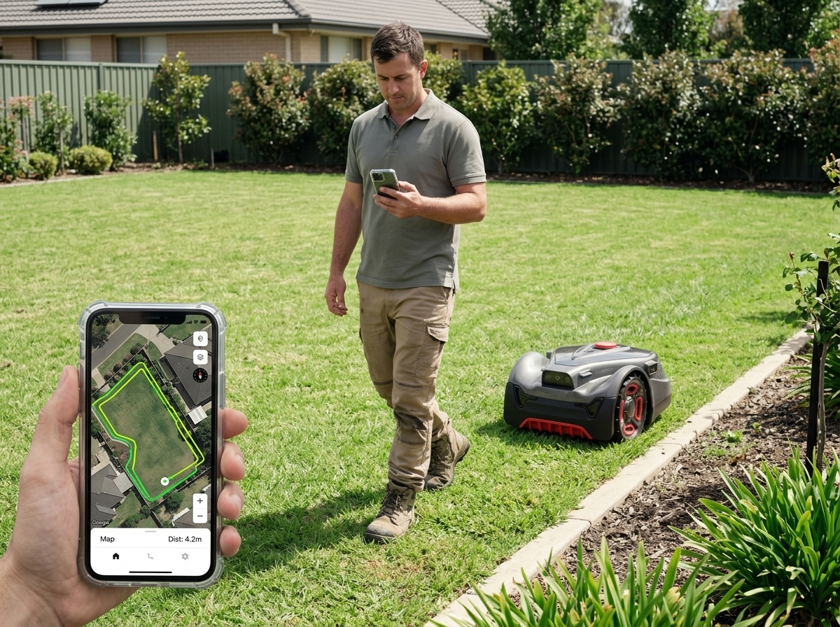
Every robot lawn mower has to answer one question thousands of times an hour: where am I right now? Get it right and the machine mows in clean, overlapping lines and comes home on its own. Get it wrong and you get missed strips, repeated passes over the same patch, and a mower that strands itself behind a shed.
The UNICUT range answers that question with GFLS — a fusion positioning system that combines RTK satellite positioning, VSLAM visual mapping and AI vision into one position estimate rather than relying on any single sensor. This article walks through what each layer contributes, why the combination matters more than any one part, and what it changes for a brand deciding how to position the product.
Why one sensor is never enough
Each positioning technology has a failure mode that its own sensor cannot detect. That is the whole problem in one sentence.
Satellite positioning is precise in the open and degrades under tree canopy or beside a tall wall. Visual mapping works well where there are stable features to recognise but struggles with a uniform expanse of grass or a scene that changes when the light does. Vision-based obstacle detection sees what is in front of the machine but does not, by itself, know where that machine sits on a map.
A single-sensor mower has to be designed around its weakest moment. A fusion system does not: when one input degrades, the others carry the estimate until it recovers. The practical result is that coverage stays consistent across the parts of a garden where single-sensor machines typically get vague — the boundary next to the house, the strip under the trees, the narrow passage between two zones.
The three layers of GFLS
GFLS is not a single sensor with a brand name on it. It is three layers whose outputs are reconciled continuously.
RTK: the absolute reference
RTK — real-time kinematic satellite positioning — supplies the absolute frame of reference. Standard consumer GPS is accurate to a few metres, which is useless for mowing: a few metres of error is the difference between cutting the lawn and cutting the flower bed. RTK improves on this by comparing the mower's satellite readings against corrections from a fixed reference point, cancelling out most of the shared error and bringing positioning to a far tighter tolerance.
RTK is what lets the mower hold a straight line across an open lawn and return to the same coordinates on the next session. Its weakness is the same as any satellite method: it needs sky. Under dense canopy or tight against a building, the signal degrades or drops.
VSLAM: continuity when the sky disappears
VSLAM — visual simultaneous localisation and mapping — builds and continuously updates a map of the visual features around the mower while tracking its own position within that map. It does not need satellites at all.
This is the layer that covers RTK's gap. When the mower passes under a tree or runs along a fence line and satellite quality falls away, VSLAM carries the position forward using what the camera can see. When the mower returns to open sky, RTK reasserts the absolute reference and any drift accumulated in the interim is corrected.
AI vision: understanding the scene
The third layer interprets what is actually in front of the machine. AI vision on the UNICUT range recognises more than 300 object types, which is what turns “something is there” into “that is a garden hose, that is a pet, that is a border”.
That distinction matters because the right response differs by object. A machine that treats every detection identically either stops constantly for things it could safely pass or fails to give a wide enough berth to things it should avoid. Recognising the object class is what allows a proportionate response — and it is also what keeps the mower on turf rather than wandering onto a gravel path that happens to be the same shade of grey as the lawn in low light.
What fusion changes in practice
Three things follow from combining the layers rather than picking one.
No perimeter wire. Because the mower knows where it is in absolute terms, the boundary can be defined virtually rather than buried in the ground. Nothing has to be trenched at installation, and the boundary can be changed later without digging it up again. This is covered in more depth in setting virtual boundaries and no-go zones.
Consistent edge behaviour. Cutting close to a border requires knowing precisely where the border is and where the machine is, at the same moment. On the H3 PRO, that combination supports edge cutting to within 1 cm. Positioning confidence is the prerequisite — a machine unsure of its position has to leave a safety margin, and that margin is exactly the uncut strip owners complain about.
Reliable unattended operation. Autonomy is only useful if it is trustworthy when nobody is watching. Rain sensing sends the mower back to the dock and resumes the job afterwards rather than abandoning it, and OTA updates mean the positioning and recognition behaviour can improve over the product's life rather than being frozen at the version that shipped.
How the range applies it
GFLS runs across the whole UNICUT range; what differs is the coverage each model is rated for and, on the H5, which layers do the heavy lifting.
| Model | Rated coverage | Notable |
|---|---|---|
| UNICUT H5 | 500 m² | Vision-only navigation |
| UNICUT H3 | 800 m² | Full GFLS fusion |
| UNICUT H3 PRO | 1,200 m² | 1 cm edge cutting, 4G connectivity |
| UNICUT H1 | 1,500 m² | Largest rated coverage in the range |
The H5 is the interesting case for buyers. It navigates on vision alone, which suits smaller, more enclosed gardens where satellite reception is compromised anyway and the area is small enough that accumulated drift never becomes significant. For larger and more open sites, the full fusion stack is what keeps accuracy stable across the whole session.
Across the range, operation stays under 59 dB and the machines carry an IPX6 rating — both relevant to how the product gets positioned in residential markets, where noise limits and weather exposure are common objections.
What this means for a brand
If you are bringing a robot mower to market under your own name, positioning technology is not a spec-sheet line item — it determines which support calls you will field. Boundary-free setup removes the installation step that generates the most pre-sale hesitation. Consistent edge performance removes the most common post-sale complaint. Recognition across 300+ object types removes the “it ran over my hose” category of returns.
Those are the arguments worth making in your own product copy, and they are the ones we can substantiate. If you are working out which model fits the lawn sizes in your market, or how an OEM, ODM or private-label program would be structured around the range, that is the conversation to have before the spec sheet.
FAQ
What does GFLS actually stand for in practice?
It is the fusion positioning system used across the UNICUT range, combining RTK satellite positioning, VSLAM visual mapping and AI vision into a single position estimate rather than relying on any one sensor.
Does a robot mower with RTK still work under trees?
Yes. Satellite quality does degrade under canopy, which is exactly the gap VSLAM covers — visual mapping carries the position forward until the mower returns to open sky and RTK reasserts the absolute reference.
Why does the UNICUT H5 use vision only?
The H5 is rated for 500 m². At that size, in the more enclosed gardens it is aimed at, satellite reception is often compromised anyway and the area is small enough that accumulated drift never becomes significant.
How close to a border can the mower cut?
The UNICUT H3 PRO supports edge cutting to within 1 cm. Precise edge work depends on the machine being confident about its own position — a mower unsure of where it is has to leave a safety margin.